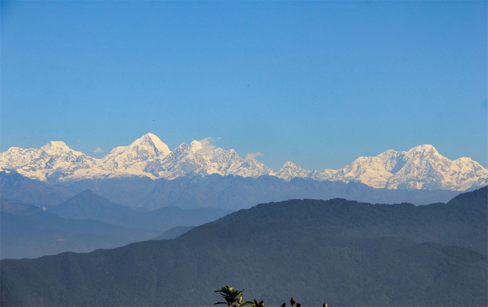
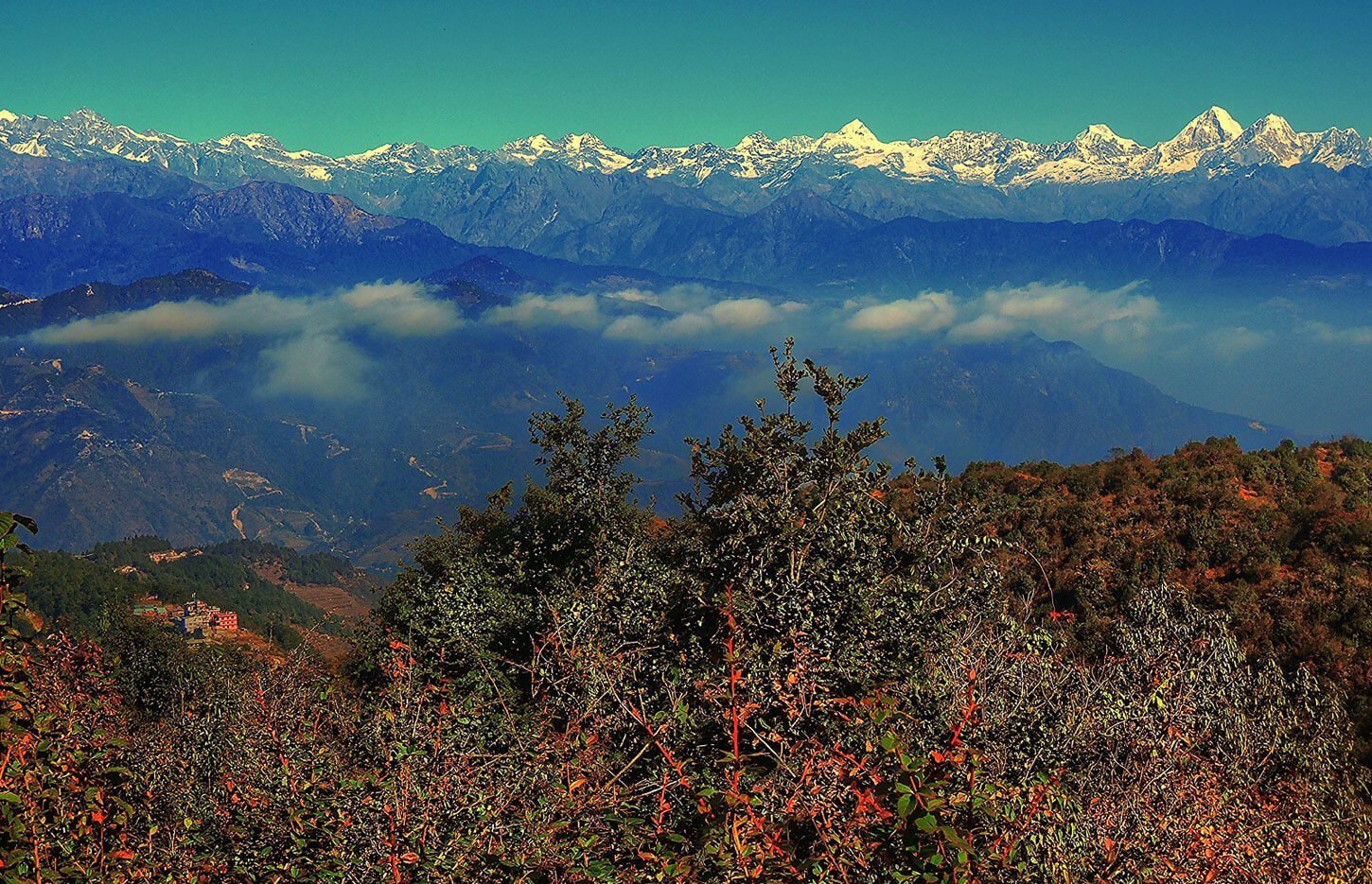
Himalayan range visible from Shivapuri National Park near Kathmandu Valley
All hikes near Kathmandu

Shivapuri & Nagarjun Hill Hike

The two closest forest hikes to Kathmandu — both inside Shivapuri Nagarjun National Park, both reachable from Thamel in under 30 minutes.

10–15 km from Thamel2.5–5 hoursPermit required

Shivapuri Peak (2,732m) and Nagarjun Hill (2,095m) are the two closest national park hikes to Kathmandu city — 15 km and 10 km from Thamel respectively. Both require a national park entry permit (NPR 1,000 for non-SAARC nationals, paid at the gate). No guide is required. Both trails are day hikes with same-day return to Kathmandu possible.

National park entry permit

Shivapuri Nagarjun National Park charges a single entry fee covering both trails. Pay cash at the respective gate (Budhanilkantha for Shivapuri, Balaju for Nagarjun).

Visitor categoryEntry fee
Non-SAARC nationalsNPR 1,000 (~USD 7.50)
SAARC nationalsNPR 250
Nepali citizensNPR 50

Trail guides

Forest trail climbing through dense woodland toward Shivapuri Peak near Kathmandu

Shivapuri Peak

2,732m · Budhanilkantha gate · 15 km from Thamel

Summit2,732m
Distance10–12 km return
Duration4–5 hrs
DifficultyModerate

Shivapuri Peak is the highest point on the northern rim of Kathmandu Valley and the most popular national park hike from the city. The standard route starts from the Budhanilkantha entrance gate — 15 km north of Thamel, 25–30 minutes by taxi — and climbs steadily through oak, rhododendron, and pine forest to the summit ridge.

The ascent gains roughly 800m over 5–6 km on a wide, well-maintained track. The forest is dense all the way up and the trail is unlikely to cause navigation problems. On clear mornings the summit gives north-facing Himalayan views — Langtang Lirung, Ganesh Himal, and parts of the Jugal Himal range are all visible. The Kathmandu bowl is visible below.

There are no tea houses or shops inside the national park on this route. Carry at least 2 litres of water and a packed lunch or snack. A jacket for the summit is advisable even in October — it can be 8–12°C above the treeline at 7am. Most hikers complete the full return trip in 4–5 hours.

Start early. By 10am the lower forest paths get warm. The national park gate opens at sunrise — a 6am start puts you on the summit ridge by 9am with morning Himalayan light.
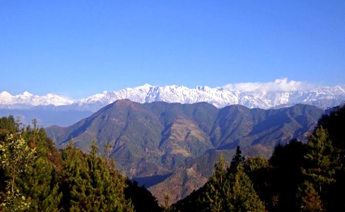
Dense forest path on Nagarjun Hill inside Shivapuri Nagarjun National Park, Kathmandu

Nagarjun Hill (Jamacho Peak)

2,095m · Balaju gate (Ring Road) · 10 km from Thamel

Summit2,095m
Distance~7 km return
Duration2.5–3.5 hrs
DifficultyEasy–Moderate

Nagarjun Hill — also called Jamacho Peak — is arguably the closest forest hike to central Kathmandu. The trailhead gate sits on the Ring Road near Balaju, about 10 km from Thamel and 20–25 minutes by taxi. It's technically inside the city boundary, which makes it the quickest escape to proper forest from any Kathmandu guesthouse.

The trail climbs through sal and pine forest to the Jamacho gompa (Buddhist monastery) at the summit, gaining roughly 500m over 3.5 km. The forest is noticeably wilder and denser than Shivapuri — less foot traffic, more birdsong, and a genuine sense of being away from the city despite the proximity. The monastery at the top is small but the terrace has views north toward the Himalayan range on clear days.

This trail is well-suited to beginners and those short on time. The 2.5–3.5 hour round trip means you can be back in Kathmandu by mid-morning if you start at sunrise. The entry permit is the same as Shivapuri (NPR 1,000 for non-SAARC nationals) paid at the Balaju gate.

Nagarjun is especially good for birdwatching — the national park protects over 300 bird species. Bring binoculars if you have them. Weekday mornings are quieter than weekends.

What to bring

Water

At least 2 litres — no water sources inside the park

Trail shoes

Proper grip for forest paths; sandals are not suitable

Cash (NPR)

Entry permit paid at the gate — no card machines

Warm layer

Summit temperatures can be 8–12°C colder than Kathmandu

Offline GPS map

Download Maps.me or Organic Maps before you leave — no signal in the park

Snacks or lunch

No tea houses or shops on either route

Comparing all Kathmandu Valley hikes?

Our full guide covers 12 day hikes in every direction from the city — distances, permits, and what each trail is like.

See the full guide

Common questions

How do I get to the Shivapuri hike from Kathmandu?

The main trailhead for Shivapuri Peak is the Budhanilkantha entrance gate, 15 km north of Thamel. A taxi from Thamel takes about 25–30 minutes and costs NPR 700–1,000. The Nagarjun Hill (Jamacho) trailhead is on the Ring Road near Balaju — roughly 10 km from Thamel, about 20–25 minutes by taxi. Both gates open at sunrise and close at dusk.

Do you need a permit to hike in Shivapuri Nagarjun National Park?

Yes. Both Shivapuri Peak and Nagarjun Hill are inside Shivapuri Nagarjun National Park, which charges an entry fee at the gate. For non-SAARC nationals the fee is NPR 1,000 (approximately USD 7.50). SAARC nationals pay NPR 250. Nepali citizens pay NPR 50. You pay cash at the gate — carry local currency. There is no trekking permit or guide requirement, but solo hikers should download an offline GPS map before entering.

How hard is the Shivapuri Peak hike?

Shivapuri Peak at 2,732m is rated moderate. From the Budhanilkantha gate the main trail climbs steadily through dense forest on a wide, well-maintained track. The total ascent is roughly 800m over 5–6 km, taking 2.5–3.5 hours to the summit. The descent by the same route takes 1.5–2.5 hours. Good footwear and water are essential — there are no shops or tea houses inside the national park on this route.

How hard is the Nagarjun Hill (Jamacho Peak) hike?

Nagarjun Hill at 2,095m is rated easy-moderate. The trail climbs through a dense sal and pine forest from the Ring Road gate to the Jamacho gompa (Buddhist monastery) at the summit. Total distance is about 7 km return with roughly 500m of ascent, taking 2.5–3.5 hours round trip. It is less strenuous than Shivapuri and suitable for beginners with basic fitness. The forest is denser and wilder than Shivapuri — give yourself time to enjoy it.

Can you see the Himalayas from Shivapuri Peak?

Yes — the summit of Shivapuri Peak gives Himalayan views to the north and northeast on clear days. The panorama includes Langtang Lirung, Ganesh Himal, and parts of the Jugal Himal range. The views are best in October and November when post-monsoon air is clearest. Kathmandu Valley is visible below on most days. Nagarjun Hill's summit gompa also has northward views but the forest canopy limits the panorama more than Shivapuri.

Is it safe to hike Shivapuri or Nagarjun alone?

Both trails are inside a national park and see moderate hiker traffic on weekends. The Budhanilkantha–Shivapuri route is well-marked and generally safe for solo hikers during daylight. Nagarjun Hill's forest trails can be quieter on weekdays — let someone know your route and expected return time. Download an offline GPS track (Maps.me, AllTrails, or Organic Maps) before you go — there is no reliable mobile signal on the upper sections of either trail. Do not hike after dark.

What is the best time to hike Shivapuri or Nagarjun?

October to December is ideal — clear air, comfortable temperatures (10–22°C at trailhead), and the best Himalayan views from Shivapuri's summit. March to May is the second-best window with rhododendrons in bloom and mild temperatures. The monsoon (June–September) makes trails slippery and views are cloud-covered; hiking is still possible but expect leeches on lower sections and occasional trail flooding. January–February is cold but clear — bring a warm layer for the summit.

Want a guided day hike from Kathmandu?

We run guided day hikes from Nagarkot with Himalayan panorama, sunrise starts, and return transport. Contact us to plan a custom day hike from Kathmandu or Nagarkot.