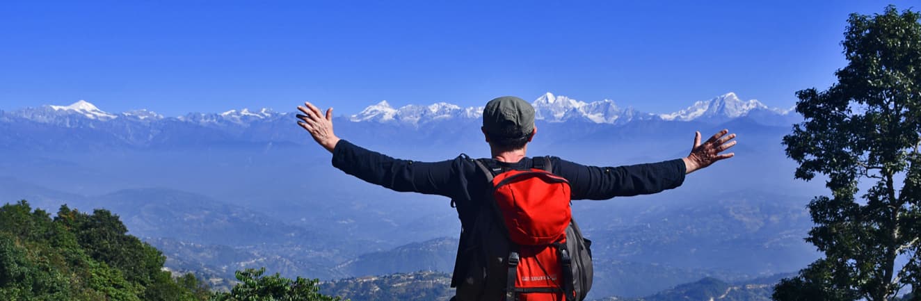
Hiking Near Kathmandu
Kathmandu Valley is ringed by forested ridgelines reaching 2,700 metres within 30 kilometres of the city. This guide covers 12 day hikes in all directions — north, south, east, and west — with real distances, trailhead logistics, permit details, and what makes each route worth your time.
- 12 trails covered
- 30 min – 2 hrs from Kathmandu
- All fitness levels
What are the best day hikes near Kathmandu?
These 12 day hikes are all reachable from Kathmandu within about 2 hours:
- 1.Nagarkot Panoramic Trail — 12 km loop, 3–4.5 hrs
- 2.Shivapuri Peak (Budhanilkantha) — 10–12 km, 3–4 hrs
- 3.Nagarjun Hill (Jamacho Peak) — ~7 km, 2.5–3.5 hrs
- 4.Nagarkot → Changu Narayan — 12 km, 4–5 hrs · UNESCO site
- 5.Phulchoki Hill — ~10 km, 5–6 hrs
- 6.Champadevi Hill — ~9 km, 3–4 hrs
- 7.Chandragiri Hills — Flexible, 2–4 hrs · cable car access
- 8.Dhulikhel Loop — 5–8 km, 2–3 hrs
- 9.Namobuddha Trek (from Dhulikhel) — ~10 km, 3–4 hrs
- 10.View Tower & Village Walk — Loop (varies), 6–7 hrs · best for beginners
- 11.Nagarkot → Dhulikhel — ~16 km, 5–6 hrs
- 12.Nagarkot → Chisapani Trek — ~22 km, 6–8 hrs · most demanding
Why Hiking in Kathmandu Valley, Nepal Is Unlike Anywhere Else
Kathmandu sits at roughly 1,400 metres in a bowl rimmed by forested ridges that climb to 2,700 metres within 30 kilometres of Thamel. What that means in practice: you can leave your guesthouse after breakfast, stand on a ridge with 200-kilometre Himalayan views by mid-morning, and be back in time for dinner. There is nowhere else in the world that puts you this close to both a functioning capital city and this quality of mountain scenery.
Hiking in Kathmandu Valley means choosing from trails in four directions off the valley rim — each with a distinct character. The northern ridges sit inside a national park and reach genuine wilderness within an hour of the city. The eastern rim around Nagarkot carries the longest unbroken Himalayan panorama, from Langtang to Everest on clear days. The southern hills are quieter, forested, and excellent for birdwatching. The west gives cable car access to 2,551 metres with minimal effort.
The day hikes from Kathmandu below range from a gentle two-hour loop to a full-day wilderness trek. I've walked all of them — most of them dozens of times. The notes on trailheads, transport, permits, and timing come from personal experience on the ground, not a travel aggregator.
Kathmandu Valley Hiking Trails by Direction
The valley rim runs in all four directions from Kathmandu city. Here's how the hiking places divide up geographically — useful if you want to combine a hike with a specific area of the valley.
National Park forest & summit hikes
Shivapuri Peak (Budhanilkantha)
15 km from city · 3–4 hrs · Highest national park summit near Kathmandu
Nagarjun Hill / Jamacho Peak
10 km from city · 2.5–3.5 hrs · Closest forest hike to central Kathmandu
Nagarkot–Chisapani Trek
32 km to start · 6–8 hrs · Crosses Shivapuri National Park interior
Nagarkot ridge & Dhulikhel valley trails
Nagarkot Panoramic Trail
32 km from city · 3–4.5 hrs · Most popular — Everest on the horizon
Nagarkot View Tower & Village Walk
32 km from city · 6–7 hrs · Best for beginners, includes sunrise
Nagarkot → Changu Narayan
32 km from city · 4–5 hrs · UNESCO World Heritage endpoint
Nagarkot → Dhulikhel Ridge Walk
32 km from city · 5–6 hrs · Classic full-day valley rim traverse
Dhulikhel Loop
30 km from city · 2–3 hrs · Easy cultural hike, best for budget travellers
Namobuddha Trek (from Dhulikhel)
30 km from city · 3–4 hrs · Sacred Buddhist monastery destination
Valley rim peaks & birding forest
Phulchoki Hill (Godavari)
20 km from city · 5–6 hrs · Highest rim point at 2,765m — best birding
Champadevi Hill (Pharping)
16 km from city · 3–4 hrs · Quiet trail, wide panorama, no permit
Cable car access & easy ridge walking
Chandragiri Hills (Thankot)
18 km from city · 2–4 hrs · Cable car to 2,551m — easiest elevation gain
Choose a Kathmandu Day Hike by Fitness Level
Not sure which trail fits your group? Use this breakdown to match the hike to your fitness level and available time.
- Chandragiri HillsCable car does the climb — 2–4 hrs of gentle ridge walking
- Dhulikhel Loop5–8 km on good paths, cultural highlights in the old town
- Nagarkot View Tower & Village Walk6–7 hrs but gentle terrain — best sunrise experience
- Namobuddha Trek (from Dhulikhel)Rolling countryside, 3–4 hrs, no sustained climbs
- Nagarjun Hill / Jamacho PeakSteep but short — 2.5–3.5 hrs, great for an early morning
- Nagarkot Panoramic Trail12 km loop, 3–4.5 hrs — most popular trail on this list
- Shivapuri Peak (Budhanilkantha)Steady climb to 2,732m summit, 3–4 hrs
- Nagarkot → Changu Narayan12 km descent through terraced countryside, 4–5 hrs
- Phulchoki HillSteep jeep track to 2,765m — forest and birding all the way
- Champadevi Hill9 km return, 3–4 hrs, quiet trails and Himalayan views
- Nagarkot → Dhulikhel16 km point-to-point ridge walk, 5–6 hrs
- Nagarkot–Chisapani Trek22 km through national park interior — remote, guide essential
All 12 Hikes at a Glance
| Trail | Distance | Duration | Difficulty | Guided Price | Details |
|---|---|---|---|---|---|
| Nagarkot Panoramic Trail | 12 km loop | 3–4.5 hrs | Moderate | $20 | View → |
| Shivapuri Peak (Budhanilkantha) | 10–12 km | 3–4 hrs | Moderate | — | — |
| Nagarjun Hill (Jamacho Peak) | ~7 km | 2.5–3.5 hrs | Moderate | — | — |
| Nagarkot → Changu Narayan | 12 km | 4–5 hrs | Moderate | $35 | View → |
| Phulchoki Hill | ~10 km | 5–6 hrs | Moderate | — | — |
| Champadevi Hill | ~9 km | 3–4 hrs | Moderate | — | — |
| Chandragiri Hills | Flexible | 2–4 hrs | Easy | — | — |
| Dhulikhel Loop | 5–8 km | 2–3 hrs | Easy | — | — |
| Namobuddha Trek (from Dhulikhel) | ~10 km | 3–4 hrs | Easy–Mod | — | — |
| View Tower & Village Walk | Loop (varies) | 6–7 hrs | Easy–Mod | $20 | View → |
| Nagarkot → Dhulikhel | ~16 km | 5–6 hrs | Moderate | $40 | View → |
| Nagarkot → Chisapani Trek | ~22 km | 6–8 hrs | Challenging | $90 | View → |
The 12 Best Day Hikes Near Kathmandu
1. Nagarkot Panoramic Hiking Trail
32 km from Kathmandu · Guided from $20
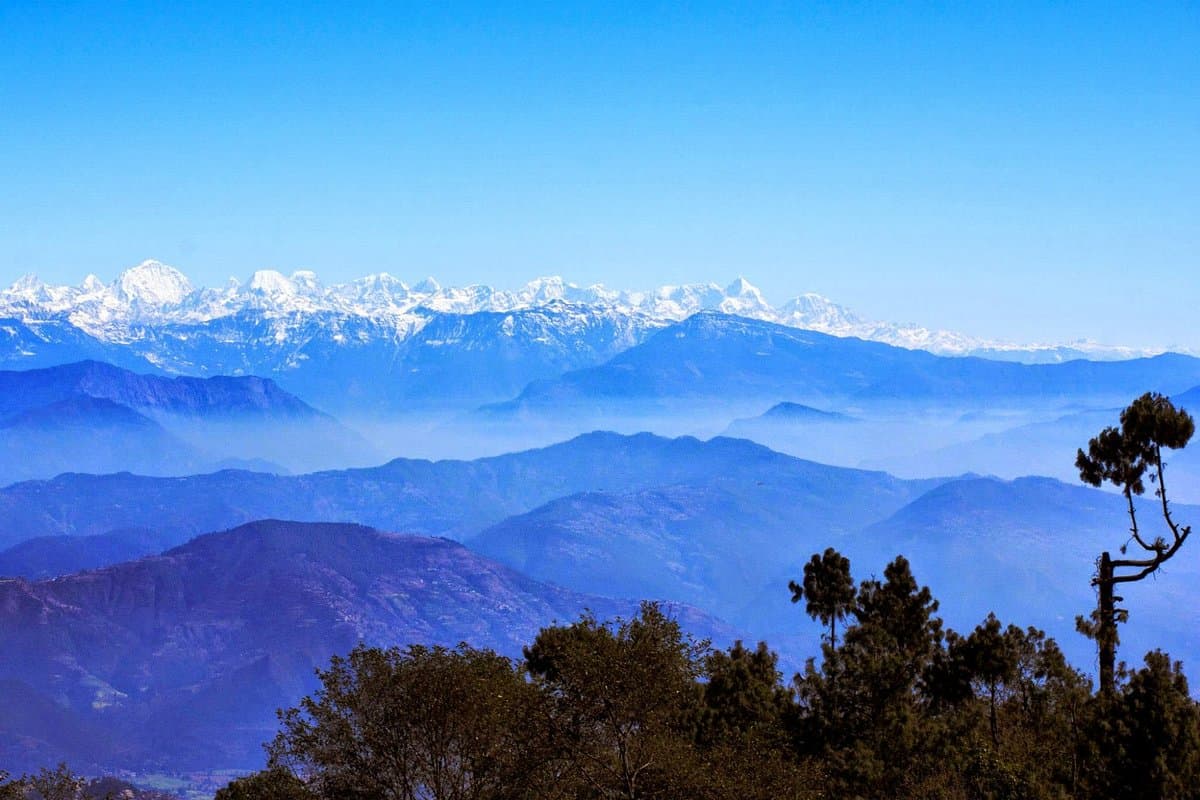
This is the trail I show visiting friends first, and it never disappoints. The Nagarkot Panoramic Loop covers 12 kilometres of chir-pine forest, open ridgelines, and traditional Tamang settlements before looping back to the village. On a clear morning — October to December are the best months — you get uninterrupted views of the Langtang range, Dorje Lakpa, Gauri Shankar, and on particularly sharp days, the unmistakable pyramid of Everest on the far eastern horizon.
The trailhead sits right in Nagarkot village, making this the most logistically simple hike on this list. From Kathmandu, a private taxi takes around 1.5 hours (NPR 5,000–6,500) or you can take the public bus from Kamalbinayak in Bhaktapur. There's no entry permit required for this trail.
The route follows the northern ridge out of Nagarkot before dropping into a section of dense pine forest where light filters through in angled shafts on autumn mornings. The second half of the loop passes through two small Tamang settlements where teahouses serve dal bhat and butter tea. If you start before 8am, you'll have the views almost entirely to yourself.
Best for: First-time visitors to Nepal, couples, families with older children, anyone wanting Himalayan views without a demanding ascent.
2. Shivapuri Peak via Budhanilkantha
15 km from Kathmandu · National Park entry
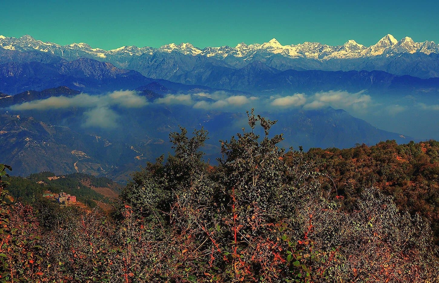
Shivapuri Nagarjun National Park's northern rim offers one of the most straightforward summit approaches near Kathmandu. The Budhanilkantha gate is reached by taxi from Thamel in about 30 minutes, and a well-marked trail climbs through mixed forest to Shivapuri Peak at 2,732m — the highest point accessible on a Kathmandu day hike.
The summit gives panoramic views north toward the Langtang range and south over the entire Kathmandu Valley spread out below. The descent on the same trail takes around 1.5 hours. Early starts give the best visibility and the freshest air before valley haze builds up.
Entry permits are purchased at the Budhanilkantha gate. The trail is clear and maintained, making this a popular choice for anyone with moderate fitness and a few hours to spare.
3. Nagarjun Hill (Jamacho Peak)
~10 km northwest of Thamel · National Park entry
Nagarjun Hill — known locally as Jamacho — sits inside the western arm of Shivapuri Nagarjun National Park, just 10 kilometres northwest of Thamel. A taxi from the city takes roughly 25 minutes to the park gate on the Ring Road near Balaju, making this one of the closest genuine forest hikes to central Kathmandu.
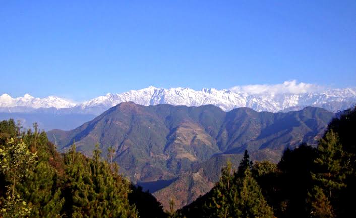
From the gate, a steep trail climbs through dense mixed forest to the Jamacho Gompa Buddhist monastery at the 2,096m summit. The ascent is direct and relentlessly uphill, but the gradient eases near the top where the monastery and its surrounding viewpoint sit on a forested knoll. The panorama from Jamacho covers the full Kathmandu Valley below and, on clear mornings from October to December, the Langtang Himalayan range to the north.
The national park entry permit (NPR 1,000 for non-SAARC visitors) is purchased at the Ring Road gate. Bring water and a snack — there are no teahouses on this trail. Return is on the same route; the descent to the gate takes around 1 hour. A popular choice for an early morning hike before the city heats up.
4. Nagarkot to Changu Narayan Temple
32 km from Kathmandu · Guided from $35
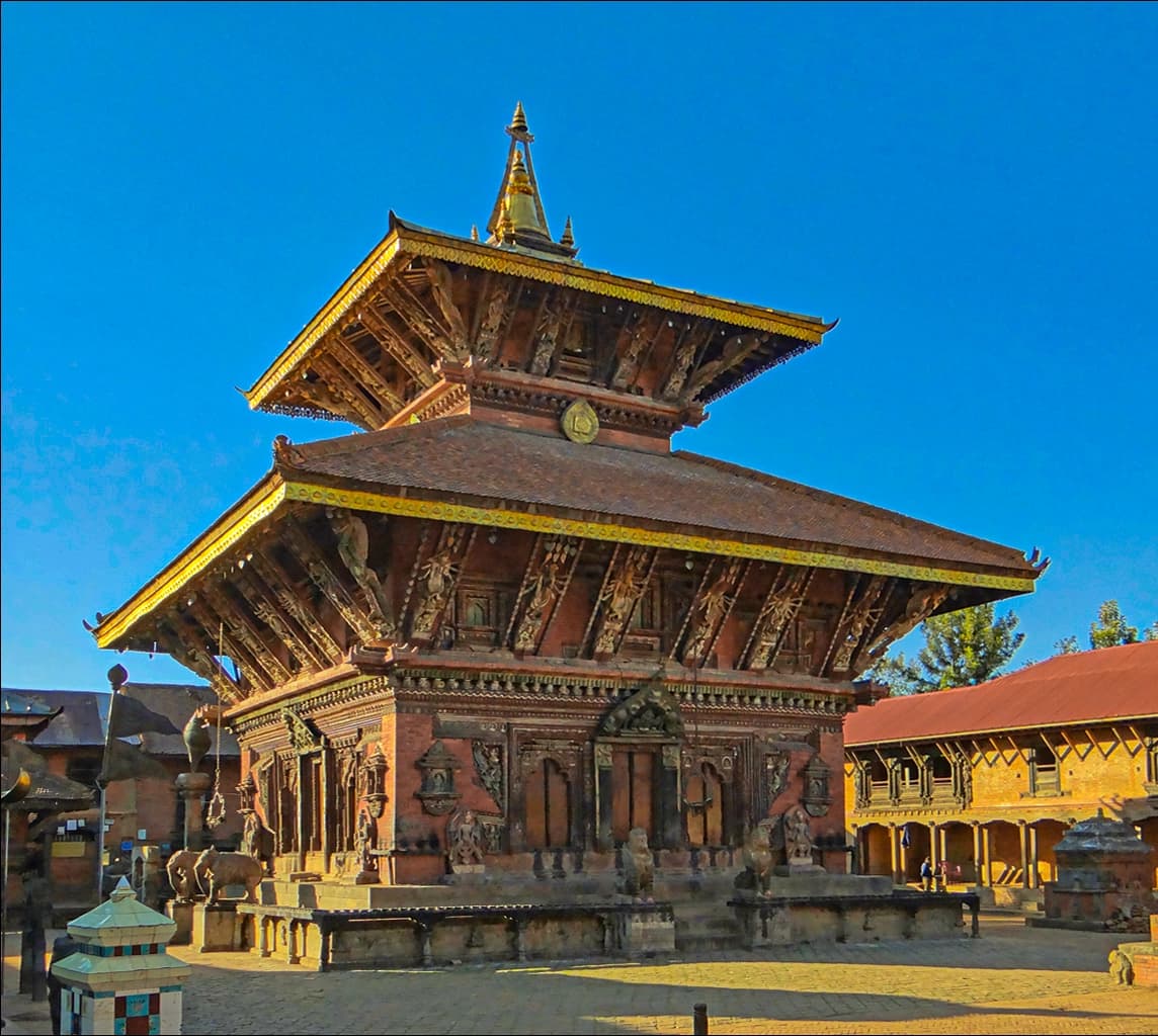
This is a point-to-point descent: you start at Nagarkot (2,175m) and walk steadily downhill through terraced farming country, forest, and several Newari villages until you reach the Changu Narayan Temple complex at around 1,541m. The temple itself, Nepal's oldest, dates to the 4th century AD and is one of the Kathmandu Valley's seven UNESCO World Heritage Sites.
The hiking is varied and never boring. The upper third is ridge trail with valley views to both sides. The middle section cuts through terraced fields where farmers work the same land their grandparents did. The lower section enters a forest of rhododendron and oak before the path widens out into the old stone paving of the Changu approach road. A taxi or local tempo can pick you up at the temple for the 45-minute return to Kathmandu, making this an entirely self-contained day out.
Note the temple entry fee of NPR 400 for foreign visitors — this contributes directly to heritage site maintenance and is well worth it. Plan at least 30 minutes to explore the temple courtyard, which contains some of the finest stone carving in Nepal.
Best for: History lovers, photographers, anyone combining hiking with cultural sightseeing.
5. Phulchoki Hill
20 km south of Kathmandu
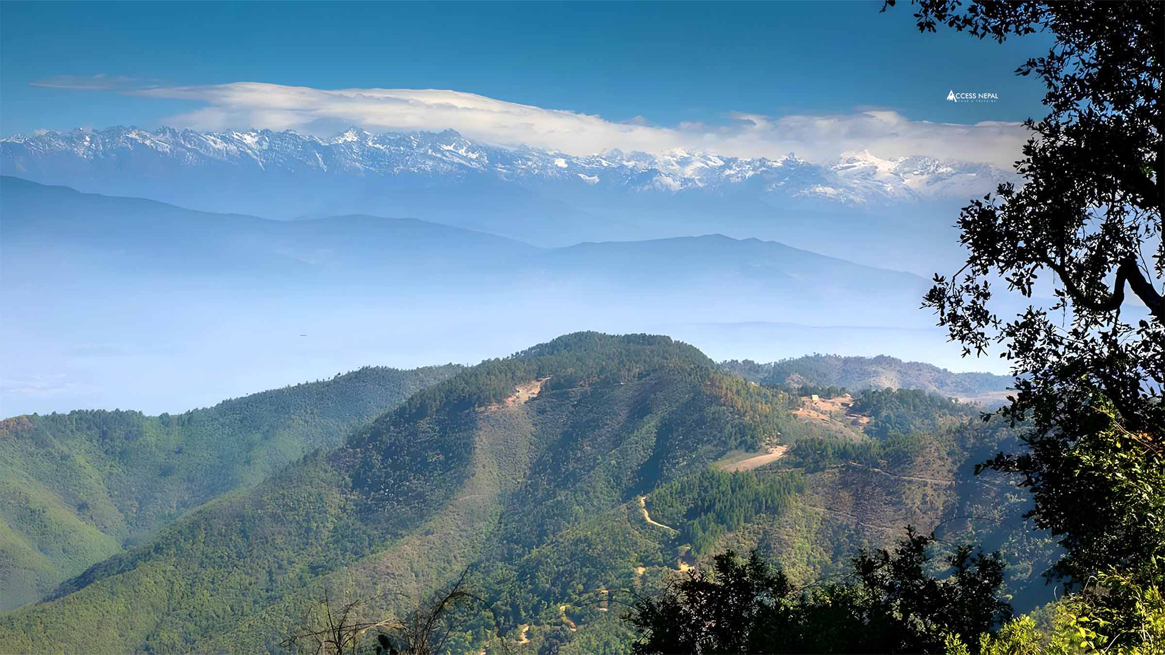
Phulchoki — literally "flower hill" in Nepali — is the highest point on the Kathmandu Valley rim at 2,765m. It's also one of Nepal's finest birding sites, sitting within a protected forest that hosts over 270 bird species including Spiny Babbler (Nepal's only endemic bird) and several species of pheasant. Between March and May the forest is painted in rhododendron colour.
The hike to the summit is direct: a forest jeep track climbs steeply from the Godavari trailhead, with a small shrine at the top and views stretching from Dhaulagiri in the west to Kangchenjunga in the east on clear winter days. The steepness makes trekking poles advisable.
Phulchoki is south of the city and the trailhead at Godavari is roughly 20 kilometres from Thamel — a 45-minute taxi ride. Fewer tourists come here than to Nagarkot, meaning quieter trails and a more genuine wilderness feel.
6. Champadevi Hill
~16 km southwest of Kathmandu
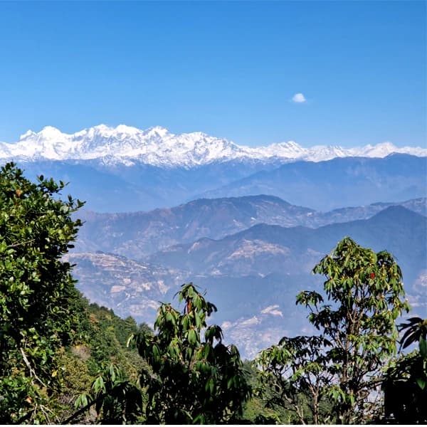
Champadevi is the high point of the valley's southern rim, rising to 2,278m above the pilgrimage village of Pharping on the southwestern edge of Kathmandu. The trailhead at Pharping is reached by taxi in around 35 minutes from Thamel — a straight run down the Dakshinkali road through Kirtipur and Chobar.
The trail climbs through pine and rhododendron forest from Pharping, passing a small Hindu temple before opening onto the summit ridge. At the top stands a white Buddhist shrine with prayer flags, and on clear days the Himalayan panorama stretches from Dhaulagiri and the Annapurnas in the west to Langtang and Dorje Lakpa in the north. The Kathmandu Valley spreads out below on one side; the wilder country south toward Makwanpur on the other.
Champadevi gets far fewer visitors than Nagarkot or Shivapuri, meaning the trails are quiet and the summit rarely crowded. No entry permit is required. Trails are generally well-worn but not always signed — downloading an offline map (Maps.me or AllTrails) is advisable. The round trip from Pharping takes 3–4 hours; combine with a stop at the Dakshinkali temple nearby.
7. Chandragiri Hills
18 km west of Kathmandu · Cable car access
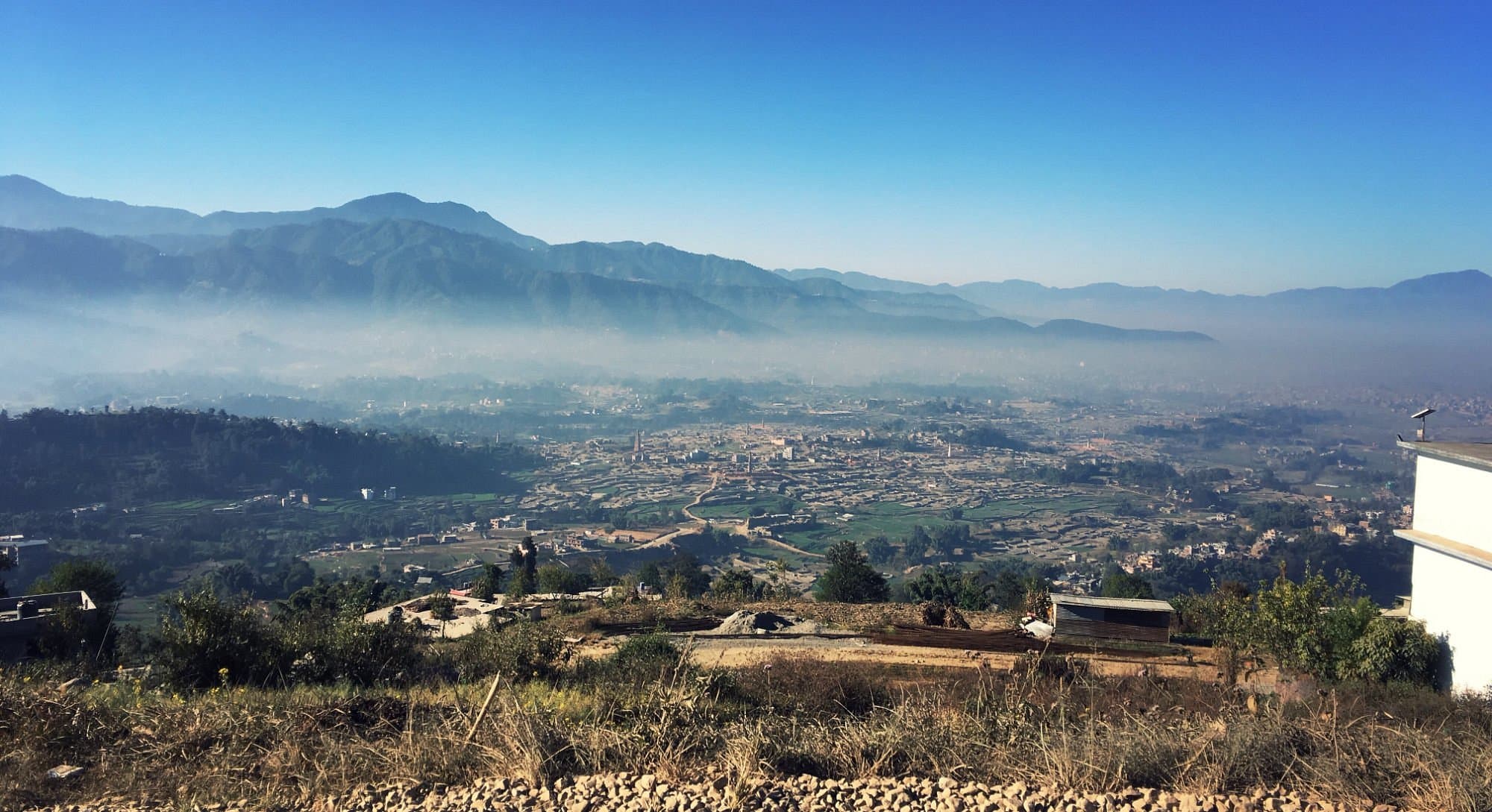
The Chandragiri cable car, which opened in 2016, runs from Thankot at the western edge of the Kathmandu Valley to a hilltop complex at around 2,551m — putting you at panoramic elevation with minimal effort. From the upper station, walking trails lead along the ridge to viewpoints, a Bhaleshwar Mahadev temple, and forested slopes to explore.
This is the most accessible option on this list: the cable car does the elevation work, the walking is gentle, and the views of Ganesh Himal, Langtang, and the Kathmandu Valley are excellent. It's a good choice for groups with mixed fitness levels, for short days, or when you want a Himalayan viewpoint without committing to a long hike.
The cable car runs daily. Check current schedules before arriving — during busy festival periods queue times can be substantial and booking ahead online is advisable.
8. Dhulikhel Loop
30 km east of Kathmandu
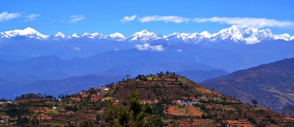
Dhulikhel is a compact Newari hill town 30 kilometres east of Kathmandu with an exceptionally preserved old quarter and a hilltop viewpoint giving wide Himalayan views from Langtang west to the Rolwaling range. The loop trail from the old town climbs to the Kali temple viewpoint (about 45 minutes), continues along a forested ridge path, and returns through farming terraces.
This is the most culturally layered easy hike on the list. Dhulikhel's medieval streets are as interesting as the walking: carved wooden windows, ancient courtyards, and small local restaurants serving excellent Newari food. Combine the hike with lunch in the old town and you have a genuinely memorable half-day out of Kathmandu.
Getting here: public bus from Ratna Park (NPR 100, 1 hour) or taxi (NPR 1,500–2,000, 45 minutes). The bus makes this the cheapest hike on the list.
9. Namobuddha Day Trek (from Dhulikhel)
~30 km east of Kathmandu (via Dhulikhel)
The Namobuddha day trek begins from the hilltop town of Dhulikhel — 30 kilometres east of Kathmandu — and follows a rolling trail through Newari villages and terraced farmland to one of the most sacred Buddhist sites in Nepal. The monastery and stupa at Namobuddha sit at around 1,750m, commanding wide views of the Himalayan foothills and a panorama that includes Langtang, Rolwaling, and on clear days, peaks as far east as Everest.
The walking is gentle with moderate ups and downs rather than sustained climbing. The trail passes through living agricultural countryside — rice terraces in monsoon, mustard fields in winter — and several traditional villages where you are likely to be the only foreign visitor that day. Plan 30–45 minutes to explore the Namobuddha monastery compound, which includes multiple temples, a stupa built over a site the Buddha is said to have visited, and an active community of Tibetan Buddhist monks.
Getting to Dhulikhel: public bus from Ratna Park (NPR 100, ~1 hour) or taxi (NPR 1,500–2,000, ~45 minutes). From Namobuddha, a local taxi or jeep can usually be arranged back to Dhulikhel or direct to Kathmandu. Alternatively, stay the night at the monastery guesthouse and return the following morning.
10. Nagarkot View Tower & Village Walk
32 km from Kathmandu · Guided from $20
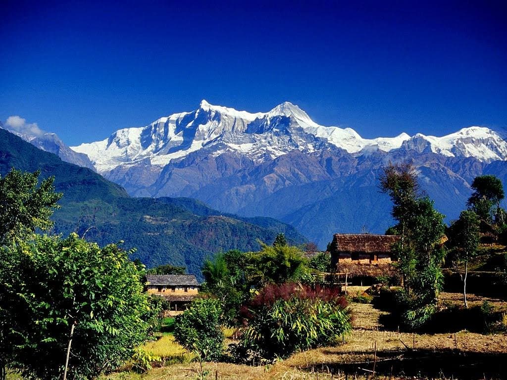
If you're choosing just one Kathmandu day hike, this is the one. Our guide picks you up from your hotel before dawn (typically 4:30–5am), drives to Nagarkot, and reaches the View Tower at 2,195m in time for sunrise. When the Himalayan horizon turns orange and then gold, with Langtang and Dorje Lakpa catching the first light, it's one of those moments that stays with you for years.
After sunrise, the guide leads you to a local family for a hot mountain breakfast — eggs, roti, butter tea, seasonal fruit. Then you walk: three hours through Tamang settlements along lanes that see almost no tourist traffic. You'll pass women carrying firewood, children heading to school, elderly men sitting in the morning sun outside stone houses. It's the Kathmandu Valley that exists between the temple circuits, unhurried and genuine.
The walking itself is gentle — well-maintained trails with no technical sections — making this perfect for families, senior travellers, or anyone who wants the full mountain experience without needing to be fit.
Best for: First-timers, families, senior travellers, anyone wanting culture and scenery combined.
11. Nagarkot to Dhulikhel Ridge Walk
32–30 km from Kathmandu (start–end) · Guided from $40
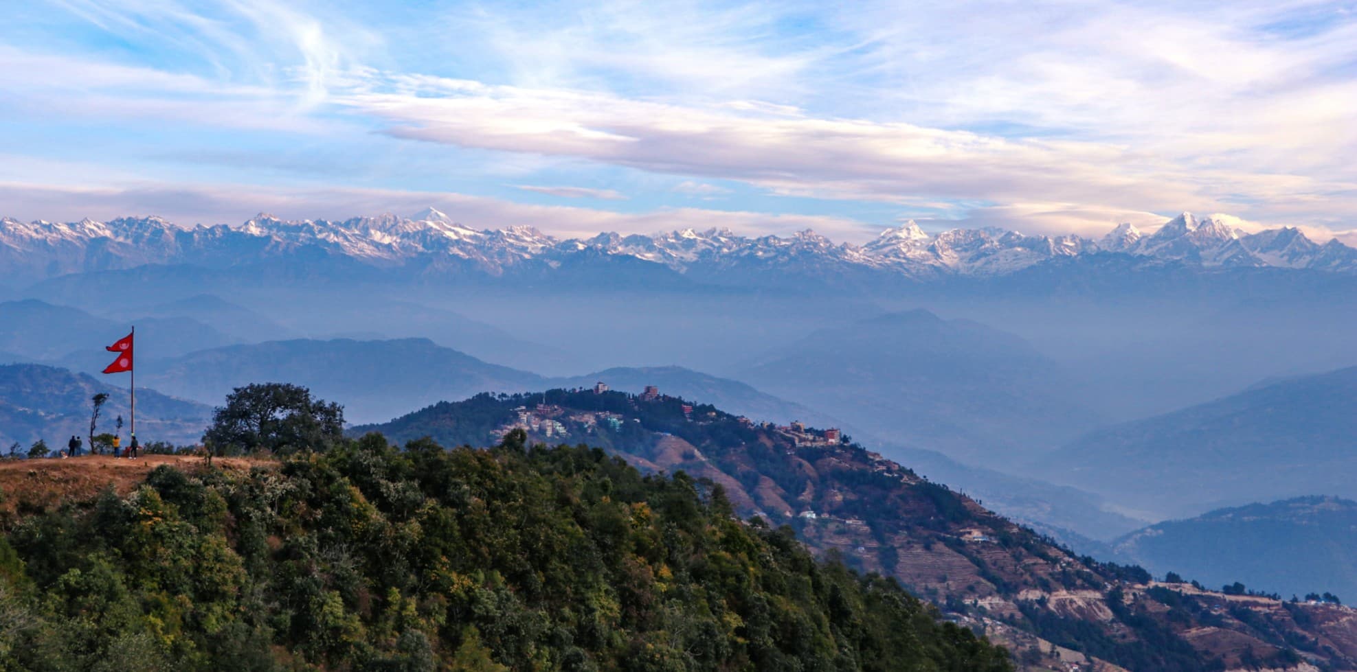
The Nagarkot–Dhulikhel traverse is the valley's classic ridge walk: 16 kilometres along the eastern rim of the Kathmandu Valley, descending through chir-pine forest and terraced hamlets from Nagarkot (2,175m) to the ancient Newari hill town of Dhulikhel (1,550m). The Himalayan panorama rides with you the entire way.
Unlike most nearby hikes, this is a genuine point-to-point requiring transport at both ends — taxi to Nagarkot at the start, transport back to Kathmandu from Dhulikhel at the finish. Dhulikhel is a worthwhile destination in itself: the medieval Newari architecture of its old town, the Kali temple on the hilltop, and the excellent local restaurants justify arriving with a little time to explore before heading back.
Trail junctions on this route are poorly marked. A guide is strongly recommended unless you have a downloaded offline map (Maps.me or AllTrails both have GPS tracks for this route).
Best for: Experienced day hikers wanting a full-day challenge with cultural payoff at the end.
12. Nagarkot–Chisapani Trek (Shivapuri National Park)
32 km from Kathmandu · Guided from $90
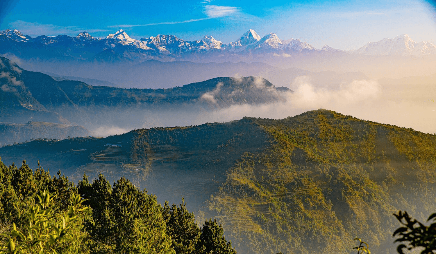
This is the valley's most serious day hike. The route runs 22 kilometres through the interior of Shivapuri Nagarjun National Park — largely wild forest, with remote Tamang villages, no phone signal for long stretches, and Langtang–Manaslu panoramas from the Chisapani ridgeline at the end. It crosses terrain that feels genuinely remote despite being within 35 kilometres of central Kathmandu.
A national park entry permit (currently NPR 500 for SAARC nationals, NPR 1,000 for others) is required and must be purchased at the park gate. The trail must begin before 7:30am to complete it comfortably. Come with proper footwear, at least 3 litres of water, and a packed lunch — resupply points are minimal inside the park. A guide is not just recommended here but essential: the park interior trail network is complex and poorly signed.
Best for: Fit hikers with trekking experience, adventure seekers, wilderness enthusiasts.
What to Pack for a Day Hike Near Kathmandu
Most Kathmandu day hikes don't require specialist gear. This is what consistently makes the difference between a comfortable day and a rough one:
Footwear & Clothing
- Trail runners or hiking shoes
Not sandals — paths are uneven on all routes
- Warm layer / fleece
Nagarkot and Shivapuri mornings are cold even in October
- Light rain jacket
Essential June–September, useful shoulder months
- Sun hat and sunscreen
Ridge sections have no shade for hours
Water & Food
- At least 2 litres of water
3 litres for Phulchoki, Chisapani, or hot days
- Snacks or packed lunch
Nagarjun Hill and Champadevi have no tea houses on trail
- Energy snacks
Chocolate, nuts, or local chiura (beaten rice) for longer hikes
Navigation & Safety
- Offline GPS map (AllTrails or Maps.me)
Cell coverage drops on Chisapani and parts of Nagarkot–Dhulikhel
- Fully charged phone
Portable battery pack recommended for full-day hikes
- Basic first aid kit
Guided hikes: your guide carries one. Solo: bring your own
Permits & Money
- Cash in NPR
Permits, tea houses, and taxis rarely accept cards at trailheads
- National park permit (where required)
Purchased at the gate — Shivapuri NPR 1,000, Phulchoki NPR 1,000
- Changu Narayan entry fee
NPR 400 for foreign visitors, paid at the temple gate
Day Hikes From Kathmandu: Getting to the Trailheads
Every hike on this list is reached from central Kathmandu (Thamel area) by one of four methods. Here's the practical breakdown:
Private taxi is the easiest option for most visitors. Ride-hailing apps Pathao, inDrive, and Yango all operate in Kathmandu and give you a fixed price before you confirm — no negotiation required. For Nagarkot, budget NPR 5,000–6,500 one way. For closer trailheads like Budhanilkantha (Shivapuri) or Godavari (Phulchoki), expect NPR 600–1,000.
Public bus is cheap and available for most destinations. Nagarkot buses depart from Kamalbinayak in Bhaktapur (itself reachable by Micro from Kathmandu). Dhulikhel buses run from Ratna Park. Budhanilkantha is served from Ratna Park. Fares are under NPR 200 for all routes.
Guided pickup — if you're hiking with Outdoor Nagarkot, transport is arranged as part of the package. We collect you from your hotel in Thamel or wherever you're staying.
Motorcycle rental is available in Thamel for those with experience riding in South Asian traffic. Roads to Nagarkot, Dhulikhel, and Chandragiri are paved. Roads to the Godavari trailhead for Phulchoki involve some rough sections.
For a full breakdown including current bus departure points and Pathao/Yango tips: our complete transport guide →
Kathmandu Valley Hiking FAQ
What are the best day hikes near Kathmandu?
The 12 best day hikes near Kathmandu are: Nagarkot Panoramic Trail (12 km, 3–4.5 hrs), Nagarkot to Changu Narayan (12 km, 4–5 hrs, UNESCO site), Nagarkot View Tower & Village Walk (6–7 hrs, best for beginners), Shivapuri Peak via Budhanilkantha (3–4 hrs, north), Nagarjun Hill / Jamacho Peak (2.5–3.5 hrs, northwest, inside national park), Phulchoki Hill (5–6 hrs, south, best birding), Champadevi Hill (3–4 hrs, southwest, quiet trail), Chandragiri Hills (2–4 hrs, west, cable car access), Dhulikhel Loop (2–3 hrs, east, cultural focus), Namobuddha Trek from Dhulikhel (3–4 hrs, sacred Buddhist stupa), Nagarkot–Dhulikhel Ridge Walk (16 km, full day), and the Nagarkot–Chisapani Trek (22 km, most demanding). All are reachable from Kathmandu within 2 hours.
Which hike near Kathmandu is best for beginners?
The Nagarkot View Tower & Village Walk is the best Kathmandu day hike for beginners. It involves gentle walking on well-maintained trails, includes a sunrise Himalayan panorama, a mountain breakfast, and a guided walk through Tamang villages — all accessible with no prior hiking experience. Chandragiri Hills (cable car access) and the Dhulikhel Loop are also good beginner options.
How do I get to hiking trails from Kathmandu?
Most trailheads are reached by private taxi (25 minutes to 2 hours), public bus, or ride-hailing apps (Pathao, inDrive, Yango). Nagarkot is 32 km from Kathmandu — a 1.5 hour taxi ride or public bus via Bhaktapur. Shivapuri's Budhanilkantha gate is 15 km north, about 30 minutes by taxi. Nagarjun Hill (Jamacho) gate is on the Ring Road near Balaju — roughly 25 minutes by taxi from Thamel. Phulchoki's Godavari trailhead is 20 km south, around 45 minutes. Champadevi starts near Pharping, 16 km southwest, about 35 minutes by taxi. Chandragiri cable car departs from Thankot, 18 km west, around 40 minutes. Dhulikhel is 30 km east, 45 minutes by taxi or 1 hour by public bus from Ratna Park.
Do I need a permit to hike near Kathmandu?
Shivapuri Nagarjun National Park (Shivapuri Peak, Chisapani Trek) requires an entry permit — currently NPR 1,000 for non-SAARC nationals, purchased at the gate. Phulchoki (Godavari entry) also charges NPR 1,000. Changu Narayan Temple charges a heritage site fee of NPR 400. Nagarkot trails (Panoramic Loop, View Tower walk, Nagarkot–Dhulikhel) have no general permit requirement. Chandragiri cable car charges separately for the ride.
What is the best time of year to hike near Kathmandu?
October to December gives the clearest air and sharpest Himalayan views — this is peak season. March to May is also excellent with rhododendron flowers and pre-monsoon light. Monsoon season (June–August) brings lush green landscapes but frequent cloud cover obscuring the high peaks and occasional muddy trails. Winter (January–February) can be cold but crisp and clear. Hiking is possible year-round near Kathmandu; most trails are accessible in all seasons except after heavy snowfall in January–February.
Can you do a day hike from Kathmandu and return the same day?
Yes — all 12 hikes on this list are designed as day hikes from Kathmandu with same-day return. The closest trailheads (Nagarjun Hill, Chandragiri) are 25–40 minutes by taxi from Thamel. The furthest (Nagarkot, Dhulikhel) are about 1.5 hours. Even the longest hike — the Nagarkot–Chisapani Trek at 22 km — can be completed and you can be back in Kathmandu by evening if you start early. Book your return taxi in advance for remote trailhead endings.
What are the best hiking places in Kathmandu Valley?
The Kathmandu Valley is ringed by forested ridges in all four directions, each offering different hiking terrain. To the north: Shivapuri Peak (2,732m) and Nagarjun Hill inside Shivapuri Nagarjun National Park. To the east: the Nagarkot ridge (Panoramic Trail, Changu Narayan, Nagarkot–Dhulikhel traverse). To the south: Phulchoki Hill (2,765m, the valley's highest rim point) and Champadevi Hill near Pharping. To the west: Chandragiri Hills with cable car access. The eastern rim trails around Nagarkot offer the longest Himalayan panorama and the most varied terrain.
Is it safe to hike alone near Kathmandu without a guide?
Popular trails like Shivapuri (Budhanilkantha route), Nagarjun Hill, and the Dhulikhel Loop are well-marked and busy enough that solo hiking is generally safe. However, several routes — especially Nagarkot–Chisapani through Shivapuri National Park — have complex junctions, no phone signal in places, and genuinely remote sections. For these, a guide is strongly recommended. On all trails, download an offline GPS track (AllTrails or Maps.me) before you leave the city, regardless of whether you're hiking solo or guided.
What should I pack for a day hike near Kathmandu?
For most Kathmandu day hikes: trail runners or hiking shoes (not sandals), at least 2 litres of water (3 litres for longer routes like Phulchoki or Chisapani), a warm layer for high-elevation starts (Nagarkot mornings can be cold even in October), sun protection, cash in NPR for permits and tea house meals, and a snack or packed lunch for trails without tea houses (Nagarjun Hill, Champadevi). Download an offline map before you go — cell coverage is unreliable on several trails. A light rain jacket is advisable from June through September.
Are there hiking trails inside Kathmandu city itself?
Nagarjun Hill (Jamacho Peak) sits just 10 km northwest of Thamel on the Ring Road — it is arguably the closest forest hike to central Kathmandu, reachable by taxi in about 25 minutes. Shivapuri's Budhanilkantha gate is 15 km north and accessible in 30 minutes. Both sit within Shivapuri Nagarjun National Park and require a small entry permit. For trails further into the valley rim — Nagarkot, Phulchoki, Dhulikhel, Chandragiri — expect 40 minutes to 1.5 hours by taxi.
Why Hire a Guide for Kathmandu Valley Hiking
You won't necessarily get lost without a guide on the more popular routes — GPX tracks are available for most trails. But what you'll miss without one is harder to replace.
Trail conditions change seasonally
Monsoon rain shifts paths. A local guide knows which junctions are currently clear, which tea houses are open, and where the trail conditions are after recent weather.
The unmarked viewpoints
The flat rock on the Panoramic Trail with the unobstructed Everest view. The bend in the Changu descent where three peaks align perfectly. These aren't on any map.
Cultural context
Tamang villages, mani walls, butter lamp shrines — knowing what you're looking at transforms a walk through the countryside into something you understand and remember.
Safety in remote sections
The Chisapani Trek and Phulchoki cover genuinely remote terrain. A guide means someone knows the route, has communication tools, and can manage an unexpected situation.
OutdoorNagarkot guides have grown up in the Kathmandu Valley villages you'll walk through. They speak English, carry first aid kits, and charge honest rates ($20–$90 depending on trail) — no middleman commission and no upselling at the trailhead.
Meet Our GuidesReady to hike?
Your Kathmandu day hike starts right here
Tell us your dates, fitness level, and what you're hoping to see. We'll match you with the right trail and a local guide who knows every step of it.